
Mount Evans Scenic Byway Is Just 2 Hours From Denver
Chilling winds whistle as byway travelers leave the comfort of their cars to scale the final 130 vertical feet to the summit of Mount Evans. The trail zigs and zags upward. Although the distance is only a quarter-mile, muscles burn and lungs crave oxygen. Within minutes, though, climbers stand on top of the world.
The thrilling quest to the top climaxes a journey filled with wondrous natural sights. Among them are ancient trees that have lived longer than Methuselah, mountain goats balancing atop craggy rock and permafrost (permanently frozen ground) rarely found outside of the Arctic tundra.
Those who travel Mount Evans byway can enjoy guided nature walks, view wildlife, hike around an alpine lake, soak in sweeping views and scale the summit.

Starting in Idaho Springs, the 28-mile road winds through Arapaho National Forest on Colorado 103 to Echo Lake. Ore tailings attest to the region’s mining era. Let’s take a look back at the history of this magnificent area before continuing our trek to the top. Mount Evans was first named Mount Rosa or Mount Rosalie. Albert Bierstadt gave this name for the wife of Fitz Hugh Ludlow, whom he later married. The name also refers to Monte Rosa, which is the highest peak in Switzerland. Bierstadt, along with his guide, approached the mountain in 1863.
They spent several days painting sketches of the area from the Chicago Lakes. Then they climbed to Summit Lake and onward to Mountain Lake. William Henry Jackson laid claim to the same feat in 1873. He took several photographs, and the summit of Mount Evans is barely visible in several of his pictures. So, the discovery still remains somewhat of a mystery.
Later, the second governor of the Colorado Territory, John Evans, was forced to resign. His resignation was due to his part in the infamous Sand Creek Massacre and the subsequent cover-up. The legislature renamed the peak in his honor.
Years later, some development took place in the area. One establishment built was the Crest House (1941-1942). It once contained a restaurant and gift shop. However, it burned to the ground in September 1979 and was never rebuilt. Instead, today it is a rock foundation with walls remaining as a windbreak. It is a place of contemplation. It also provides a viewing platform providing a premier scenic overlook of Colorado.

Returning to our journey, as the altitude increases, ponderosa pines and blue spruce forests give way to towering lodgepole pines. Stands of aspen carpet entire slopes, promising gold-bullion radiance in the autumn. Mount Evans Massif rises into full view. At Ponder Point, travelers can pull off to admire its raw grandeur.
Midway up the route, the elevation reaches 2 miles above sea level. Anglers cast their lines into shimmering Echo Lake. Its lakeside picnic ground offers a restful spot to have lunch before continuing the ascent.
At the end of the lake, the byway turns onto Colorado 5 and enters the Mount Evans Wilderness Area. (Fee charged at entrance.) Subalpine fir and Engelmann spruce anchor their roots in thin topsoil, bending and dwarfing into krummholz (crooked trees) as the elevation nears timberline.
One of Colorado’s few stands of bristlecone pines highlights Mount Goliath Natural Area. Despite dry, brutal winds, little precipitation and extreme temperatures, many of these extraordinary trees are more than 1,500 years old. On Bristlecone Pine Loop, visitors can stroll among these twisted and gnarled survivors whose trunks grow only an inch in diameter a century.
During the summer, forest rangers lead nature walks several times a day on M. Walter Pesman Trail from Lower Goliath Trailhead. On the moderately difficult 1.5-mile route, visitors learn hints for identifying wildflowers. The Old Man of the Mountain, for example, wears a “hairy coat” on its stem. Bistort smells like dirty socks. And whereas queen’s crown is cone-shaped, king’s crown is flat-topped. Exhibits in the Dos Chappell Nature Center provide additional information.

Alpine Garden Loop, located at Upper Goliath Trailhead, offers a shorter wildflower hike. Rangers keep a weekly list of blossoming flowers to assist those exploring on their own.
As the byway climbs above timberline, a thin turf of cushion plants, grasses and sedges carpets the landscape. At the lofty elevation of 13,001 feet, partially frozen Summit Lake glistens. Permafrost distinguishes this alpine area. Tiny tundra flowers hug the soil. A short hike beyond the lake opens onto a marvelous view of the glaciated valley of Chicago Creek.
Wildlife, including bighorn sheep, marmots and ptarmigans, thrive here. On summer weekends, the Colorado Division of Wildlife volunteers help visitors identify animals’ distinguishing characteristics with displays of pelts and horns, and with spotting scopes. Mountain goats, for example, have long, white hair and black, spiked horns. In comparison, Rocky Mountain bighorn sheep sport buff-brown coats, and the rams have massive, curled horns.
The byway’s final ascent winds through vast fields strewn with boulders and dappled with small snowfields. The dark, jagged profile of Sawtooth Ridge rises to the west. In a deep valley, an alpine lake mirrors the sky. A mere 130 feet below Mount Evans’ summit, the road ends in a parking lot. Travelers pull on fleeces and jackets to protect against the wind and a temperature 30 degrees or more cooler than Denver.
While visitors explore, white-haired mountain goats may be standing just a few feet away, licking gneiss and granite rocks for their minerals. Or the surefooted animals may jump from boulder to boulder.
On a clear day, spectacular vistas display Colorado’s landmarks like a topographical map. To the north tower Longs Peak and other high summits of Rocky Mountain National Park. To the east, the prairie rolls to the horizon. From southeast to southwest, the vista crescendos from Pikes Peak to the Sangre de Cristos to South Park to the Collegiate Range. To the immediate west, visitors can look down upon the dome of 14,060-foot Mount Bierstadt.

Travelers can take in these sights from various points in the parking lot, but the best view requires hiking the strenuous quarter-mile trail to the top. The reward for reaching “the top of the world” more than compensates for the effort — a glorious 360-degree panorama of Colorado’s mountains and plains.
If You Go
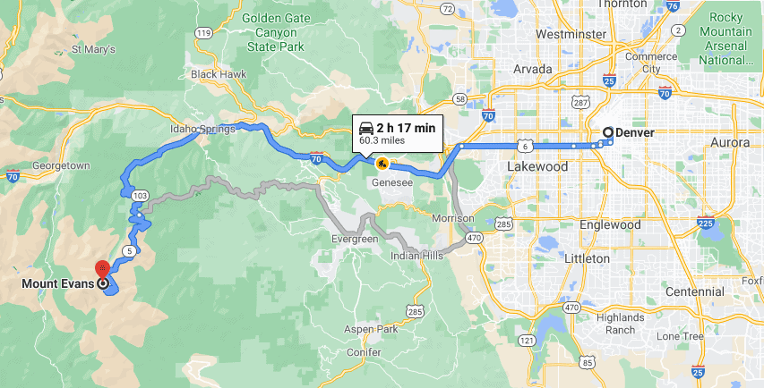
The Mount Evans Scenic and Historic Byway climbs from Idaho Springs on Colorado 103 to Echo Lake, and then on Colorado 5 to the 14,264-foot summit of Mount Evans. To access the byway, follow Interstate 70 to Idaho Springs and take Exit 240. The drive is 56 miles round trip and takes about two hours.
The route is great for viewing mountain goats, Rocky Mountain bighorn sheep and ancient bristlecone pines. The segment from the fee station to the summit is open to vehicles from Memorial Day to Labor Day, longer if weather permits. There are no vehicle restrictions. Access to the summit, wildflowers and wildlife viewing make summer the best time to explore.
Idaho Springs Visitor Center and Heritage Museum, 303-567-4382
www.historicidahosprings.com
USFS-Clear Creek Ranger District, 303-567-3000
www.fs.fed.us/r2/arnf/about/organization/ccrd/index.shtml
Rose and David Muenker, who live in Denver, are co-authors of the award-winning Colorado Front Range History Explorer, a guidebook featuring history-oriented sites and attractions of our state’s most populous region, and Colorado Front Range Scenic & Historic Byways.
From the Editors: We spent a heap of time making sure this story was accurate when it was published, but of course, things can change. Please confirm the details before setting out in our great Centennial State.

